
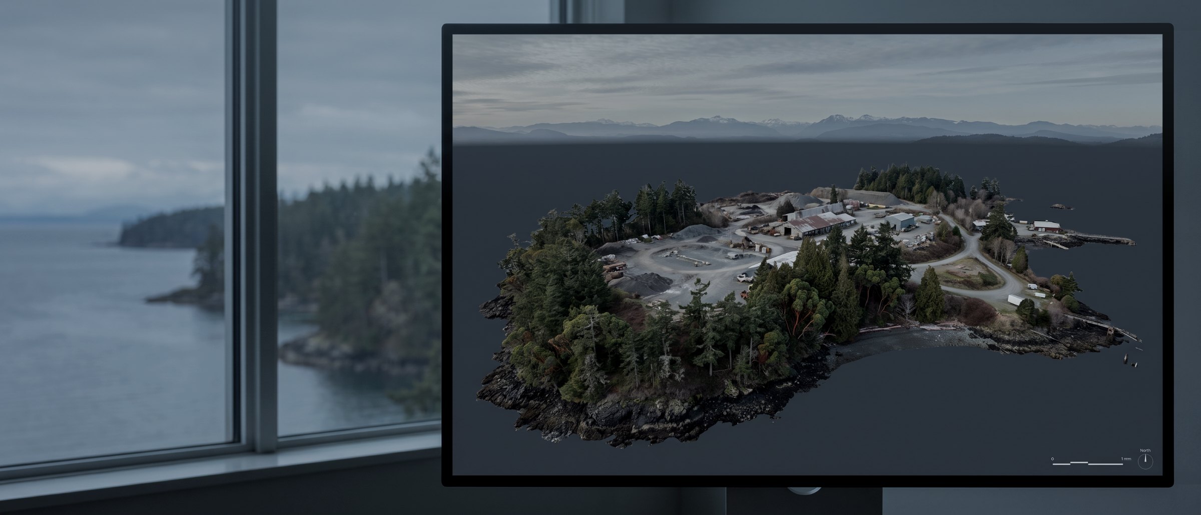
Desk work. No flight required.
Point cloud processing and classification, 3D mesh and digital twin production, and CAD, BIM and GIS deliverables — built from our captures or from yours. No mobilisation, no weather risk, no airspace dependency.
What this service is
Flying is the visible half of aerial survey. The other half is what happens to the data afterwards, and it is where most of the value and most of the ways to get it wrong live. Automatic ground classification under dense conifer, for instance, routinely misclassifies low vegetation as terrain and produces a bare-earth model that is smoothly, confidently wrong.
We do this work on our own captures as a matter of course. We also do it as a standalone service for firms who already fly — engineering practices, survey firms, contractors with a pilot on staff — and who need the processing done properly, or need it in a format their software will actually open.
Send us what you have
Imagery, point clouds, or both, with whatever control you observed. We will tell you what can be built from it before you commit, including the case where the honest answer is that the capture will not support the deliverable you want.
What we build
LiDAR processing and classification
Trajectory solution, point cloud generation, and ground classification with manual review rather than an automatic pass shipped unchecked. See LiDAR survey.
Point cloud production
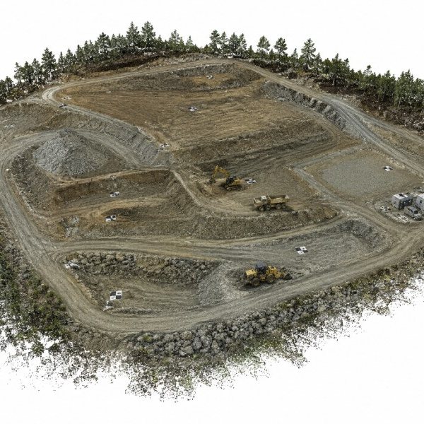
Colourised, thinned, tiled and delivered in the class scheme and format your software expects, with a stated coordinate system and datum.
Textured 3D meshes
Measured geometry with photographic texture, for clash review, remote inspection, stakeholder presentation and volume analysis.
CAD, BIM and GIS deliverables
DXF, LandXML, TIN surfaces, RCP point clouds, shapefiles and georeferenced rasters. Delivered into your package rather than handed over as a conversion job.
Digital twins
A measured model maintained on a repeat capture schedule, so the comparison between versions is the product rather than the model itself.
Panoramas and virtual site tours
High-resolution aerial panoramas and linked site tours for remote review and stakeholder access.
Formats
| Output | Format | Goes into |
|---|---|---|
| Point cloud | LAS / LAZ / RCP / E57 | Civil 3D, Recap, CloudCompare, QGIS |
| Surface | DXF / LandXML / TIN | Civil 3D, 12d, Trimble Business Center |
| Mesh | OBJ / FBX / glTF | Blender, 3ds Max, Revit, web viewers |
| Raster | GeoTIFF | QGIS, ArcGIS, AutoCAD Map |
| Vector | SHP / GeoJSON / DWG | Any GIS or CAD package |
| Panorama / tour | Hosted link | Browser, no plug-in |
| Mobilisation | None |
|---|---|
| Weather risk | None |
| Third-party data | Accepted |
| Classification | Manually reviewed |
| Typical turnaround | 3–5 days |
| Sample review | Before you commit |
A model inherits the accuracy of the capture it was built from. Areas of low coverage confidence are flagged rather than presented as uniform surface. Survey deliverables are provided for information and planning purposes and are not a legal survey. Boundary, legal plan and statutory right-of-way work requires a British Columbia Land Surveyor.
What your procurement team will ask for
We fly under a Transport Canada Advanced Operations certificate with licensed pilots, which is the level required to operate in controlled airspace and near people. Airspace authorisations are obtained before mobilisation, and the airframe carries a certified parachute for work near occupied areas.
We carry $5M in aviation liability insurance and a certificate is available on request for your project file. WorkSafeBC clearance is available, site safety orientation is completed on arrival, and we work to the host contractor's requirements.
Survey deliverables are provided for information and planning purposes and are not a legal survey. Boundary, legal plan and statutory right-of-way work requires a British Columbia Land Surveyor.
- Transport Canada Advanced Operations certificate
- Licensed pilots, current flight reviews
- $5M aviation liability insurance
- WorkSafeBC clearance letter available
- Certified parachute for operations near people
- Airspace authorisation handled by us
- Written method note on every job
Processing, answered
Can you process data I captured myself?
Yes, and it is a substantial part of this work. Send a sample of the imagery or point cloud plus the coordinate system and any control you observed, and we will confirm what can be built from it before you commit to anything. Processing-only engagements carry no mobilisation, no weather risk and no airspace dependency, which makes them the fastest thing we do.
What formats can you deliver into CAD or BIM?
Point clouds as LAS, LAZ or RCP for Autodesk workflows. Surfaces as DXF, LandXML or a TIN. Meshes as OBJ, FBX or glTF. Georeferenced rasters as GeoTIFF. If your team works in a specific package, tell us which and we will deliver into it rather than handing you a conversion job.
What is a digital twin, practically?
For our purposes it is a measured, georeferenced 3D model of an asset or site that is updated on a schedule, so that the model reflects the current state rather than the state at handover. The value is not the model itself but the comparison between versions — what moved, what was built, what deteriorated. Without a repeat capture programme a digital twin is just a 3D model with a better name.
How accurate is a mesh model?
A mesh inherits the accuracy of the capture it was built from, so photogrammetric meshes carry the 3cm horizontal and 5cm vertical figures of the underlying survey where ground control was used. Visual fidelity and measurement accuracy are different properties, though: a mesh can look convincing and still be geometrically unreliable in areas of poor coverage. We flag areas of low confidence rather than presenting a uniform surface.
Do you produce renders and animations?
We produce the measured model and can deliver flythrough animation from it. Architectural visualisation and rendered marketing imagery is a different discipline and we work alongside studios who specialise in it — several are clients, and we supply the survey they build on.
Tell us about the site
Location, rough area, what the data is for and your timeline. That is usually enough to quote without a site visit, and our team typically replies within one business day.
If a capture will not support the deliverable you have in mind, we will tell you that before invoicing rather than after.