
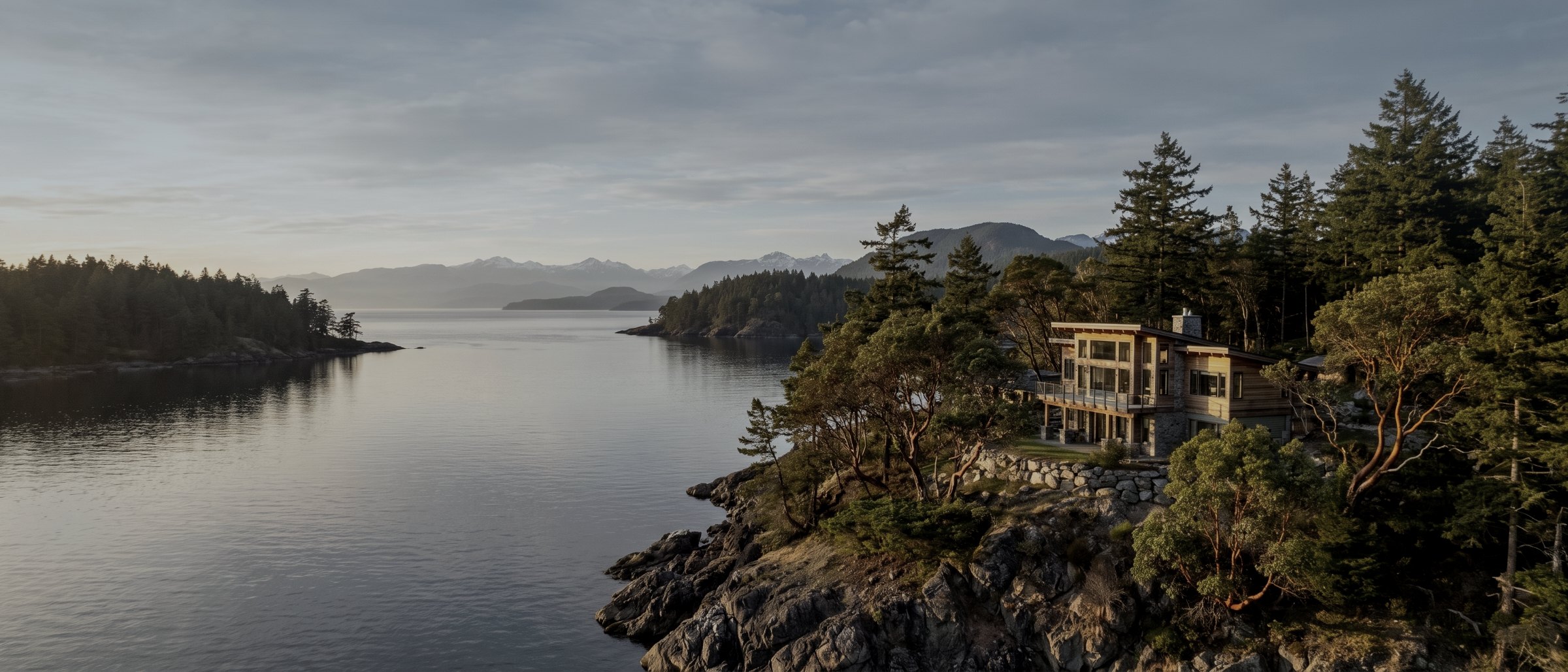
Imagery that has to hold up, and imagery that has to sell.
Aerial photography and video across Vancouver Island: project documentation, stakeholder and community visuals, evidentiary records for insurance and dispute files, and property and development imagery. Flown by the same certified, insured crew as the survey work.
Two kinds of aerial imagery
Most of what gets called drone photography is one thing: pictures chosen because they look good. That work is real, we do it well, and for a property listing or a development brochure it is exactly what is needed.
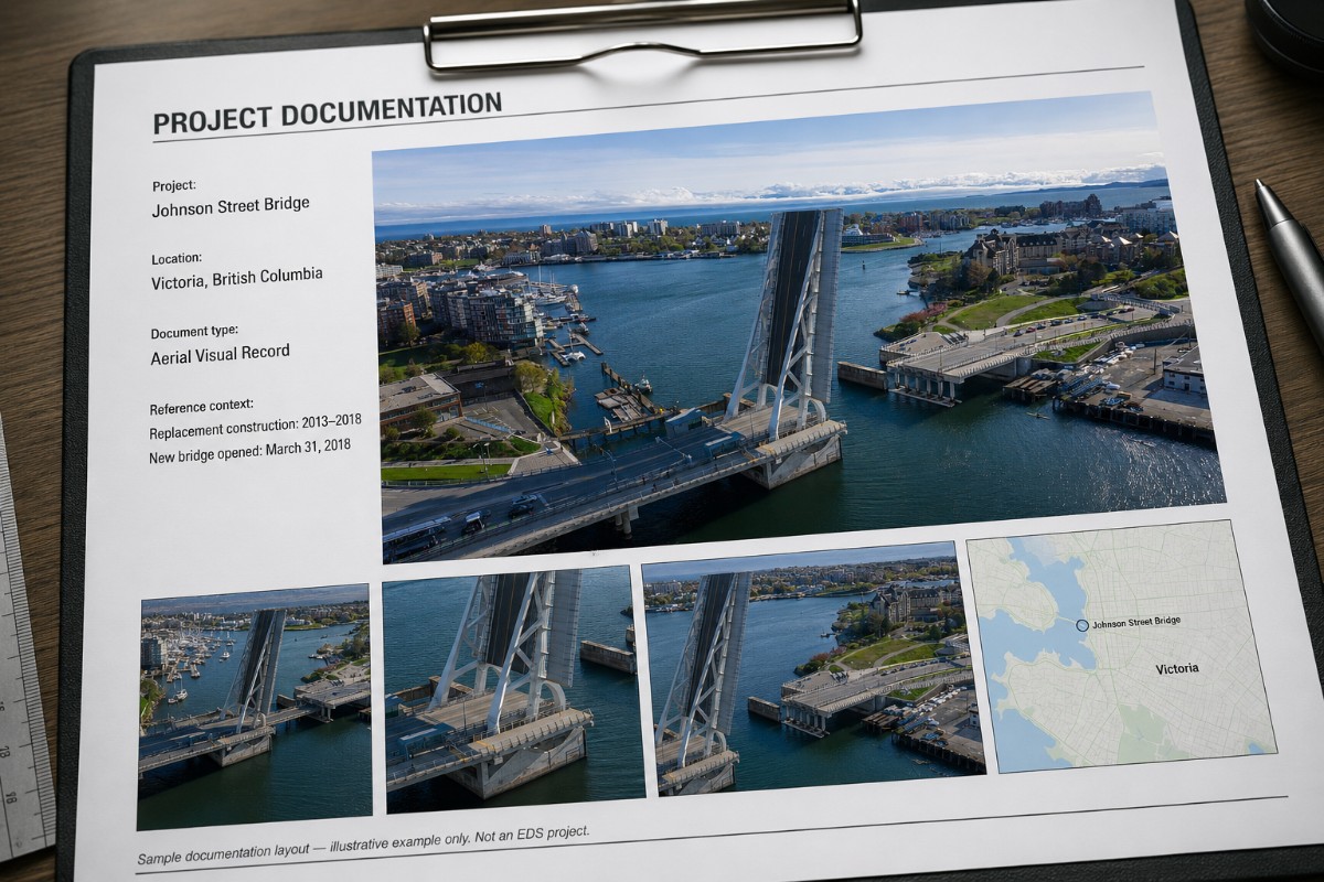
The other kind is documentation, and it is captured to a different standard. Systematic coverage rather than selected angles. Dated and positioned. Retained unedited. Its job is not to be attractive but to establish what a site looked like on a particular day — which is what an insurer, a lawyer or an owner’s representative needs when something is contested.
Both come off the same aircraft, flown by the same certified pilot under the same insurance. What differs is the protocol, and it is worth telling us at the outset which one you need.
What we shoot
Project and site documentation
A dated record of a project as it proceeds, for owner reporting, marketing and archive. Frequently flown alongside progress monitoring so one attendance serves both.
Stakeholder and community visuals
Imagery for consultation, permitting submissions and public information, where an aerial view explains a proposal faster than a drawing set.
Insurance and evidentiary documentation
Systematic dated capture before remediation, retained unedited. Captured to a protocol suited to a file that may be contested.
Real estate and development marketing
Property, parcel and development imagery that shows the whole site and its context rather than just the building elevation.
Corporate and industrial
Facility, plant and operations imagery for annual reports, tender submissions and website use, on sites where access and safety rule out a ground crew.
Media and production support
Aerial units for documentary and commercial production, with the certification and insurance a broadcaster or studio will ask to see.
Recent media work







I highly recommend Elite Drone Solutions! David is highly skilled, professional and wonderful to work with.
Elite Drone Solutions has always provided us with an exceptional service and a high quality finished product.
What arrives
| Deliverable | Format | Notes |
|---|---|---|
| Graded stills | JPEG + TIFF | Full resolution, colour corrected, web and print sets |
| Video | MP4 / ProRes | Cut to an agreed length, plus raw clips on request |
| Documentation set | JPEG, unedited | Systematic coverage, dated and positioned, retained as captured |
| Aerial panorama | Hosted link | High-resolution, browser-based, no plug-in |
| Usage rights | Yours | No further licence fee. We ask before portfolio use |
| Typical attendance | 2–4 hours |
|---|---|
| Stills turnaround | 48 hours |
| Video turnaround | 5–7 days |
| Site stoppage | Not required |
| Certification | TC Advanced |
| Insurance | $5M |
Where imagery is intended for an insurance or dispute file, tell us at the outset: the capture protocol changes, and documentation is retained unedited with its capture conditions recorded.
What your procurement team will ask for
We fly under a Transport Canada Advanced Operations certificate with licensed pilots, which is the level required to operate in controlled airspace and near people. Airspace authorisations are obtained before mobilisation, and the airframe carries a certified parachute for work near occupied areas.
We carry $5M in aviation liability insurance and a certificate is available on request for your project file. WorkSafeBC clearance is available, site safety orientation is completed on arrival, and we work to the host contractor's requirements.
Aerial media work is flown under the same Transport Canada Advanced Operations certificate and the same $5M aviation liability insurance as our survey work. Certificates are available for production and client files on request.
- Transport Canada Advanced Operations certificate
- Licensed pilots, current flight reviews
- $5M aviation liability insurance
- WorkSafeBC clearance letter available
- Certified parachute for operations near people
- Airspace authorisation handled by us
- Written method note on every job
Across Vancouver Island
Based in Victoria, mobilising Island-wide and to the mainland for larger programs. Travel beyond the Capital Regional District is quoted at cost and stated up front.
Victoria & Saanich
Same-week mobilisation. YYJ controlled airspace handled routinely.
Langford & Westshore
Heavy residential and commercial development.
Nanaimo & central Island
Industrial, port and aggregate operations. YCD coordination.
Duncan & Cowichan
Forestry tenures, agricultural land, gravel operations.
Courtenay & Comox
North Island forestry and development. YBL coordination.
Elsewhere in BC
Mainland and remote programs on a mobilisation basis.
Aerial media, answered
Do you do real estate photography?
Yes. Aerial photography for property listings, developments and land parcels is straightforward work we do regularly, and the certification and insurance behind it is the same as on our survey work. Ask on the quote form and we will price it.
What makes evidentiary documentation different from photography?
Intent and rigour. Marketing imagery is chosen to look good. Evidentiary documentation is captured systematically, dated, positioned, and retained unedited, because its purpose is to establish what a site looked like at a specific moment. If the images may end up in a claim or a dispute file, tell us at the outset, because the capture protocol changes.
Can you film while other work is happening on site?
Yes. We coordinate exclusion zones with the site supervisor and work around plant movement rather than requiring it to stop. On active industrial sites this is routine, and our Advanced Operations certification and parachute-equipped airframe are what permit flight near people.
Do you edit video?
We deliver graded stills and cut video to an agreed length. Complex post-production, motion graphics and broadcast finishing is a separate discipline and we work alongside studios who do it — several are clients. Tell us what the footage is for and we will advise whether you need us or us plus them.
Who owns the footage?
You do. Deliverables are yours to use without further licence fee. We ask before using any project imagery in our own portfolio, and a refusal is not a problem.
Tell us about the site
Location, rough area, what the data is for and your timeline. That is usually enough to quote without a site visit, and our team typically replies within one business day.
Footage and stills are yours to use without further licence fee. We ask before using any project imagery in our own portfolio, and a refusal is not a problem.