
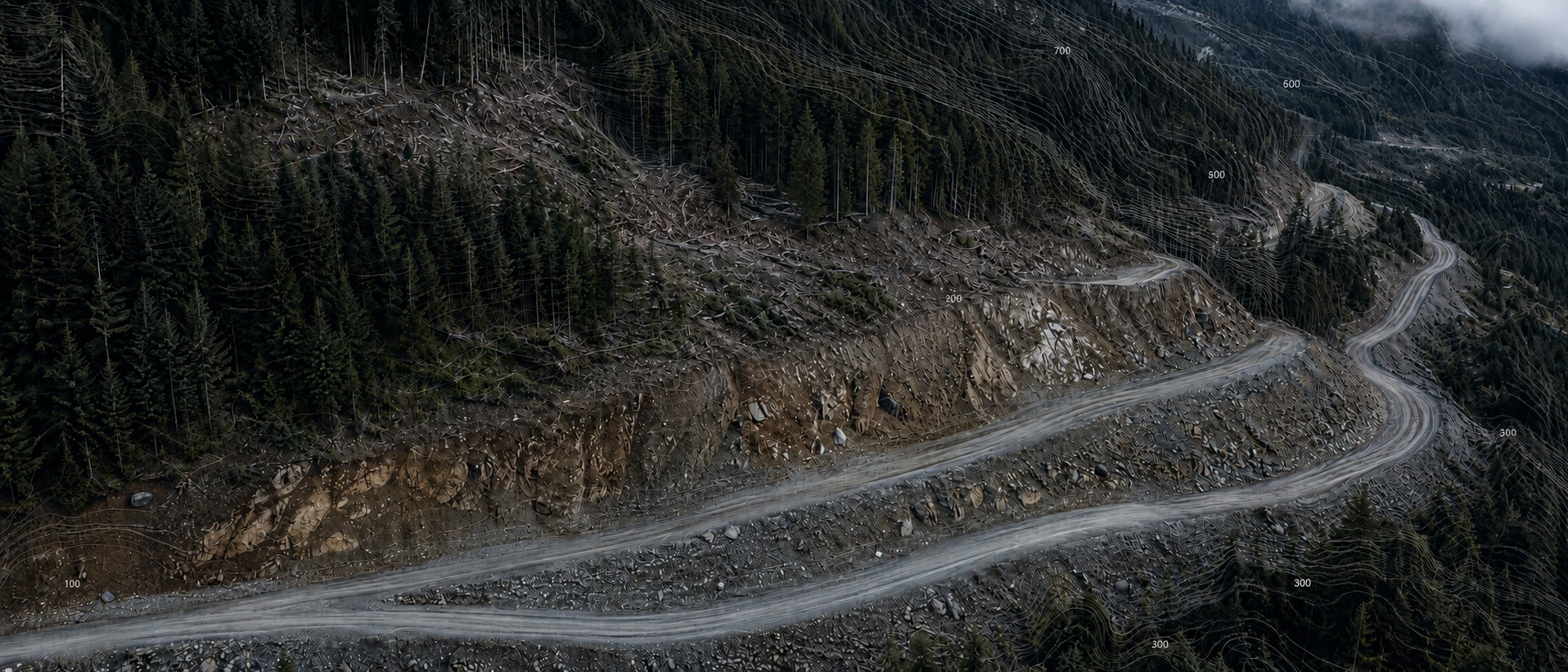
Contours your designer can build from.
Drone topographic survey across Vancouver Island. Contours at your chosen interval, spot elevations, breaklines and a terrain model, delivered in your project coordinate system and vertical datum with the achieved accuracy stated in writing.
What a topographic survey gives you
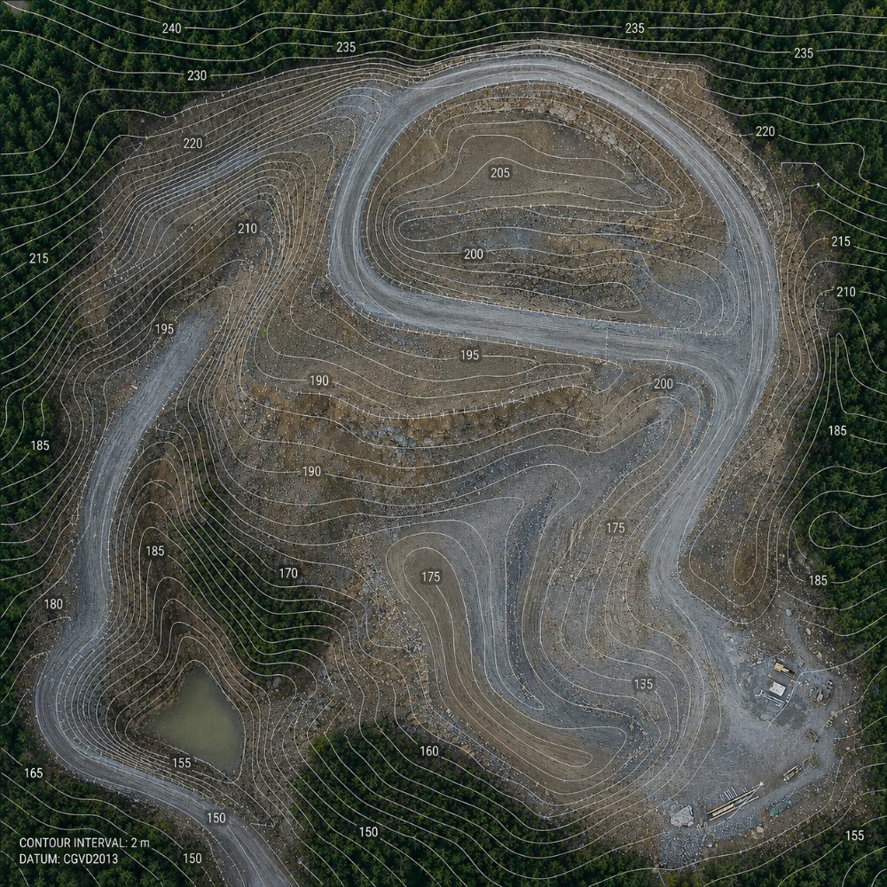
A topographic survey describes the shape of the ground: where it is high, where it is low, and how steeply it changes in between. For a civil engineer, a landscape architect or anyone planning earthworks, it is the base drawing everything else sits on. Without it, a design is an assumption.
Flown from the air, the survey is a dense measurement of the whole surface rather than a scatter of points somebody chose to occupy. From that surface come contours at whatever interval the drawing needs, spot elevations, breaklines along hard edges, and a terrain model your software can compute cut and fill against directly.
Which capture method your site needs
On open or lightly vegetated ground, photogrammetry is the right method: more accurate in absolute terms, and materially cheaper. Where canopy hides the ground, LiDAR is the only aerial method that can measure the surface beneath it. We size the method to the site rather than the invoice, and if the site genuinely needs a ground crew we will say so.
Who asks for it
Civil design
Existing-ground surfaces for road, drainage and grading design, at the interval and in the datum your engineer specified.
Development permitting
Topographic drawings for rezoning and development permit submissions, dated to the current condition of the site rather than to whenever the last survey happened.
Earthworks planning
A base surface to compute cut and fill against, before a machine moves. Frequently pays for itself on the first quantity revision.
Landscape and site planning
Accurate ground shape and existing feature positions for landscape architects working at parcel scale.
Forestry road layout
Terrain under canopy for road grade and stream crossing design, which requires LiDAR rather than photogrammetry. Forestry services.
Agricultural drainage
Fine-interval surfaces for drainage and irrigation planning on flat ground, where small elevation differences determine where water goes.
Specifications
| Deliverable | Format | Notes |
|---|---|---|
| Contours | DXF / SHP | Interval of your choosing; 0.25 m and 0.5 m most common |
| Spot elevations | CSV / DXF | Measured points behind the interpretation |
| Breaklines | DXF | Manually delineated hard edges. Quoted separately — it is desk time |
| Terrain model | GeoTIFF DTM | Grid resolution to suit the project |
| Surface model | GeoTIFF DSM | Includes vegetation and structures |
| Orthomosaic | GeoTIFF | Base imagery to draw over |
| Method & accuracy note | Control network, check point residuals, achieved accuracy |
| Photogrammetric accuracy | 3 cm / 5 cm |
|---|---|
| LiDAR accuracy | 5 cm / 4 cm |
| Contour intervals | 0.25–1 m |
| Standard turnaround | 72 hours |
| Coordinate system | Your project grid |
| Default datum | CGVD2013 |
Accuracy figures are manufacturer system specifications for the payload deployed, verified per job against independent check points excluded from the solution. Survey deliverables are provided for information and planning purposes and are not a legal survey. Boundary, legal plan and statutory right-of-way work requires a British Columbia Land Surveyor.
What your procurement team will ask for
We fly under a Transport Canada Advanced Operations certificate with licensed pilots, which is the level required to operate in controlled airspace and near people. Airspace authorisations are obtained before mobilisation, and the airframe carries a certified parachute for work near occupied areas.
We carry $5M in aviation liability insurance and a certificate is available on request for your project file. WorkSafeBC clearance is available, site safety orientation is completed on arrival, and we work to the host contractor's requirements.
Survey deliverables are provided for information and planning purposes and are not a legal survey. Boundary, legal plan and statutory right-of-way work requires a British Columbia Land Surveyor.
- Transport Canada Advanced Operations certificate
- Licensed pilots, current flight reviews
- $5M aviation liability insurance
- WorkSafeBC clearance letter available
- Certified parachute for operations near people
- Airspace authorisation handled by us
- Written method note on every job
Across Vancouver Island
Based in Victoria, mobilising Island-wide and to the mainland for larger programs. Travel beyond the Capital Regional District is quoted at cost and stated up front.
Victoria & Saanich
Same-week mobilisation. YYJ controlled airspace handled routinely.
Langford & Westshore
Heavy residential and commercial development.
Nanaimo & central Island
Industrial, port and aggregate operations. YCD coordination.
Duncan & Cowichan
Forestry tenures, agricultural land, gravel operations.
Courtenay & Comox
North Island forestry and development. YBL coordination.
Elsewhere in BC
Mainland and remote programs on a mobilisation basis.
Topographic survey, answered
What contour interval should I ask for?
It depends on the terrain and what the drawing is for. On relatively flat sites 0.25 m gives designers something to work with; on steep ground 0.5 m or 1 m is usually more legible. If your engineer has specified an interval, we match it. If nobody has said, tell us the slope and the purpose and we will recommend one rather than defaulting to the finest setting and inflating the file.
Is this a legal survey?
No. A topographic survey describes the shape of the ground. It says nothing about where a boundary runs, and in British Columbia anything relating to a property line, a legal plan or a statutory right of way must be carried out by a British Columbia Land Surveyor. We work alongside BCLS firms regularly and frequently supply the terrain data they build on.
Can you survey a treed site?
Photogrammetry cannot, because a camera measures the top of the canopy rather than the ground beneath it. LiDAR can, because a laser pulse can return from the forest floor through gaps in the trees. If your site has meaningful vegetation and you need ground elevations, the answer is LiDAR and we will quote it that way rather than selling you a cheaper survey that measures the wrong surface.
What coordinate system do you deliver in?
Whatever your project uses. By default NAD83(CSRS) UTM Zone 10N with CGVD2013 heights, which covers most work on Vancouver Island, but we will deliver in a local project grid, a different UTM zone or an assumed datum on request. Tell us at the quote stage, because retro-fitting a datum is more work than setting it correctly at the start.
Do I get spot elevations as well as contours?
Yes. Contours are an interpretation of a surface, and designers often want the measured points behind them. We deliver the surface model, the contours and a spot-elevation set, plus breaklines on request where a hard edge such as a kerb or a top-of-bank needs to be delineated manually.
Tell us about the site
Location, rough area, what the data is for and your timeline. That is usually enough to quote without a site visit, and our team typically replies within one business day.
If the work requires a legal survey, a boundary determination or a professional seal, that is BCLS or engineering practice and we will point you to it rather than working around it.