
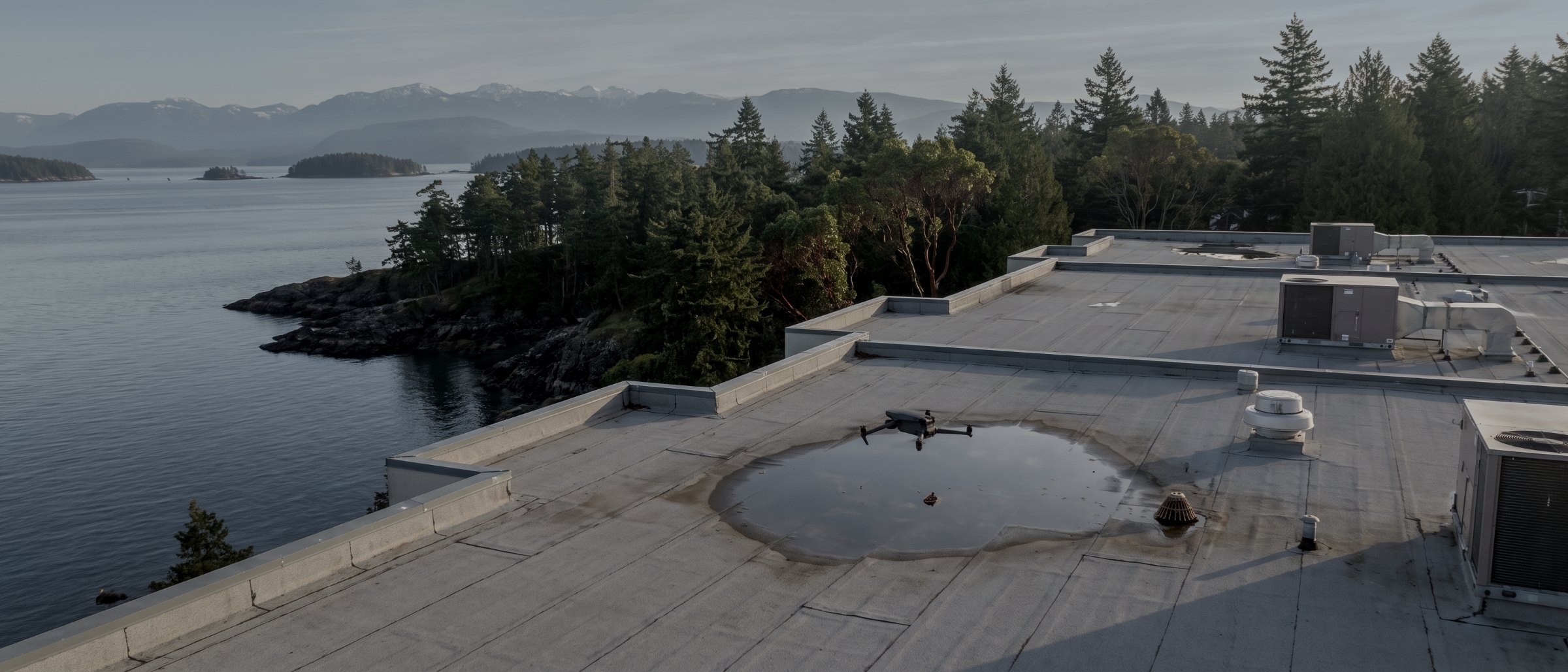
See the defect without sending anyone up there.
Close-range aerial inspection of structures, roofs, envelopes and industrial plant across Vancouver Island. Located, dated, high-resolution evidence — indexed so your engineer can interpret it, not decipher it. No scaffolding, no rope access, no shutdown in most cases.
What a drone inspection actually is
An inspection flight is a systematic capture, not a photo shoot. The aircraft works a planned pattern around or across the asset at a fixed standoff distance, recording overlapping high-resolution imagery in which every frame knows where it was taken from. Where heat is the question rather than shape, a radiometric thermal sensor records the same pattern.
What comes back is not a folder of pictures. It is an indexed set in which any finding can be located on the asset — north elevation, panel 14, third insulator from the crossarm — so that whoever has to act on it can find it again without a second visit.
What we deliver, and what we deliberately do not
We deliver evidence. We do not deliver a verdict. In British Columbia, condition assessment and structural evaluation are reserved practice for professional engineers, and an operator who hands you a report saying a structure is sound is doing something they are not entitled to do. Our capture is built to be interpreted by your engineer, and a significant share of our inspection work is commissioned by engineering firms for exactly that reason.
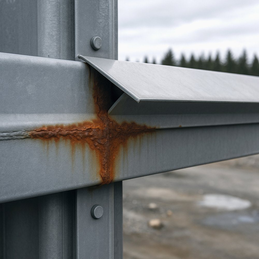
Why fly it instead of climbing it?
Against rope access or scaffolding
Rope crews and scaffolding put people at height, take days to set up on a large structure, and cost accordingly. A drone reaches the same surfaces in hours with nobody off the ground, which removes the fall exposure from the job entirely rather than managing it.
Where rope access still wins is contact: hammer testing, thickness readings, anything requiring a hand on the surface. A flight is frequently used to decide where those hands need to go, which is cheaper than sending them everywhere.
Against a bucket truck
A boom needs ground access, a level pad and traffic management, none of which exist on a hillside or over water. It also reaches one point at a time. A drone covers an entire structure from every angle in a single deployment and does not care what is underneath it.
Against a walk-round with a camera
A ground-level inspection sees the bottom third of an asset and guesses at the rest. Roof surfaces, upper connections, the far side of a structure and anything above eave height are simply not visible, which is exactly where weather-driven deterioration concentrates.
What we get called for
Roof and building envelope
Membrane condition, flashing, ponding, blocked drains and mechanical plant on commercial and institutional roofs. Combined with a measured orthomosaic so areas can be taken off for a repair scope rather than estimated.
Structural and infrastructure
Bridges, retaining structures, marine structures, towers and industrial steelwork. Close-range imagery of connections, coatings and corrosion, captured from angles a ground inspection cannot reach.
Powerline and transmission corridors
Structure condition, hardware, and vegetation clearance measured rather than estimated. See powerline inspection.
Thermal and electrical
Radiometric thermal capture of connections, switchgear and roof moisture, flown on the same mobilisation as the visual pass. See thermal inspection.
Post-event and insurance documentation
A dated, located record of damage after a storm or an incident, captured before remediation begins. Frequently the difference between a settled claim and a contested one.
Pre-purchase and due diligence
Independent visual documentation of a building or facility for a buyer, lender or insurer, at a level of coverage a walk-round cannot produce.
What arrives
| Deliverable | Format | Notes |
|---|---|---|
| Indexed image set | JPEG + CSV index | Every frame carries position; index maps frames to asset components |
| Findings log | PDF + CSV | Observations located and described. Observations, not conclusions |
| Radiometric thermal set | R-JPEG | Where thermal is in scope. Retains per-pixel temperature data |
| Measured orthomosaic | GeoTIFF | Optional. Lets areas and lengths be taken off for a repair scope |
| 3D model | OBJ / mesh | Optional, for complex geometry and remote review |
| Flight and method note | Date, conditions, coverage, standoff distance, sensor used |
| Typical standoff | 3–10 m |
|---|---|
| Coverage per day | 1–4 structures |
| Standard turnaround | 48–72 hours |
| Post-event response | 1–2 business days |
| Asset shutdown | Usually not required |
| Certification | TC Advanced |
We provide inspection data and documentation. Condition assessments, structural evaluations and geotechnical opinions are reserved practice under the Engineers and Geoscientists BC framework and are not offered; evidence is supplied for a qualified professional to interpret.
How an inspection runs
Define the question
What defect classes matter, what standoff and sensor those need, and what your engineer or maintenance system needs the output to look like. This conversation determines whether the flight is useful.
Plan and authorise
Airspace review, Transport Canada or NAV CANADA authorisation, and the asset owner’s own permit and safety requirements. Near YYJ, YCD and YBL the airspace step is not optional.
Site orientation
Safety orientation on arrival, exclusion zone established, and the flight pattern confirmed against what is actually on site rather than what was on the drawing.
Capture
The planned pattern flown at fixed standoff, with coverage verified on site before demobilisation. Anything obviously significant is flagged before we leave.
Index and deliver
Imagery indexed to asset components, findings logged as located observations, and the set delivered with a method note recording the conditions on the day.
What your procurement team will ask for
We fly under a Transport Canada Advanced Operations certificate with licensed pilots, which is the level required to operate in controlled airspace and near people. Airspace authorisations are obtained before mobilisation, and the airframe carries a certified parachute for work near occupied areas.
We carry $5M in aviation liability insurance and a certificate is available on request for your project file. WorkSafeBC clearance is available, site safety orientation is completed on arrival, and we work to the host contractor's requirements.
We provide inspection data and documentation. Condition assessments, structural evaluations and geotechnical opinions are reserved practice under the Engineers and Geoscientists BC framework and are not offered; evidence is supplied for a qualified professional to interpret.
- Transport Canada Advanced Operations certificate
- Licensed pilots, current flight reviews
- $5M aviation liability insurance
- WorkSafeBC clearance letter available
- Certified parachute for operations near people
- Airspace authorisation handled by us
- Written method note on every job
Across Vancouver Island
Based in Victoria, mobilising Island-wide and to the mainland for larger programs. Travel beyond the Capital Regional District is quoted at cost and stated up front.
Victoria & Saanich
Same-week mobilisation. YYJ controlled airspace handled routinely.
Langford & Westshore
Heavy residential and commercial development.
Nanaimo & central Island
Industrial, port and aggregate operations. YCD coordination.
Duncan & Cowichan
Forestry tenures, agricultural land, gravel operations.
Courtenay & Comox
North Island forestry and development. YBL coordination.
Elsewhere in BC
Mainland and remote programs on a mobilisation basis.
Drone inspection, answered
Do you provide a condition assessment?
No, and this matters. Condition assessments, structural evaluations and geotechnical opinions are reserved practice for professional engineers in British Columbia. What we deliver is evidence: high-resolution located imagery, thermal data where relevant, and an index that ties every frame to a position on the asset so your engineer can interpret it without asking where a photograph was taken. Several of our clients are engineering firms who use our capture as the basis for their own assessment.
How close can you fly to a structure?
Close enough to resolve the detail the inspection needs, which on most assets means a few metres. Our Advanced Operations certification and the certified parachute on the airframe permit operations near people and structures that a Basic-certified operator cannot legally undertake. Distance is set by the airspace authorisation, the asset owner’s safety requirements and wind on the day, and we confirm what is achievable before mobilising.
Can you inspect without shutting down the asset?
Usually, and that is often the main reason to fly it. A drone inspection does not require scaffolding, a rope crew, a bucket truck or a de-energised circuit, so in most cases the asset stays in service while we work. Where an owner requires a shutdown or a restricted window, we work to that.
What resolution do you capture at?
Detail sufficient to identify the defect classes you are looking for, which we agree at the quote stage. Corrosion, cracked insulators, ponding water and lifted membrane seams all need different standoff distances and different sensors. Telling us what you are looking for is more useful than specifying a megapixel count.
How is the imagery organised?
Every frame carries its position, and the delivery is indexed so that a defect can be located rather than merely described. On larger assets we deliver against a component numbering scheme you supply, so findings drop straight into your maintenance system rather than needing to be transcribed.
How quickly can you respond after a storm?
Weather-driven inspections are treated as priority work and we will normally mobilise within one to two business days on the south Island, subject to the weather that follows the event and to airspace. If you have assets that would need urgent post-event assessment, tell us now and we will hold your details rather than starting cold.
Often quoted together
Tell us about the site
Location, rough area, what the data is for and your timeline. That is usually enough to quote without a site visit, and we reply within one business day.
If an asset needs contact testing, a professional structural assessment or a geotechnical opinion, we will say so and supply the capture your engineer works from rather than overstepping.