
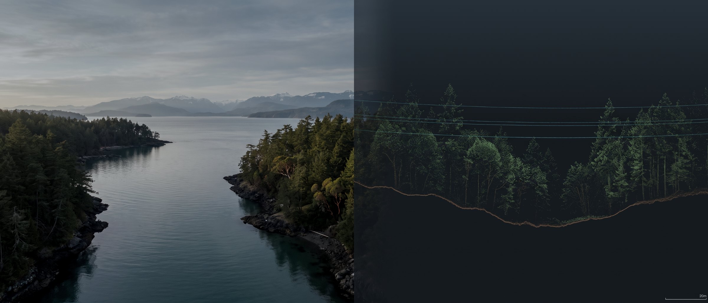
Send us the data. Get back the deliverable.
LiDAR processing and classification, point cloud and 3D model production, and CAD, BIM and GIS outputs — built from our flights or from yours. If you already own the aircraft and the pilot, this is the half of the job that is easiest to get wrong.
Who this is for
Engineering practices, survey firms, forestry consultancies and contractors who already fly — who have the aircraft, the certificate and a pilot on staff, and who need the data turned into something their software will open and their client will accept. We take the raw capture and hand back the deliverable, under your name if that is how the job is set up.
It is also the route in when the flying has already happened. Data captured last season, a corridor flown by a previous contractor, an archive nobody ever processed properly: all of it can be reworked, and the honest assessment of whether it is worth doing comes before the quote rather than after.
The half that fails quietly
A bad flight is obvious. A bad classification is not — it produces a clean-looking bare-earth surface that is wrong under exactly the vegetation you needed to see through, and nobody finds out until a road alignment or a volume reconciliation comes back off by more than the tolerance allowed. Every surface here is reviewed by hand against profile sections before it leaves.
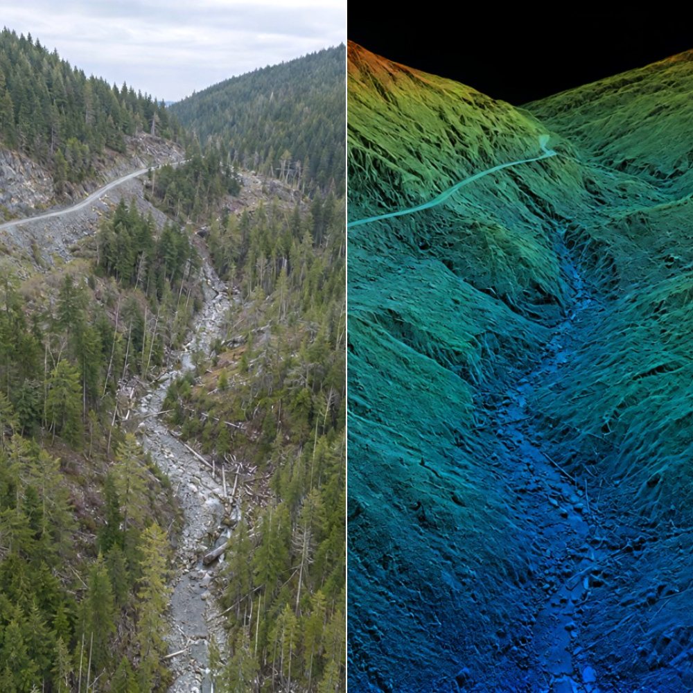
What we build
LiDAR processing & classification
Trajectory solution, strip adjustment, noise removal, and ground, vegetation, building and wire classification to your specification or to the Province's LiDAR spec. Manual review of the ground class rather than an automatic pass shipped unchecked. Capture side is on the LiDAR survey page.
Point cloud & 3D model production
Colourised, thinned, tiled and merged clouds delivered in the class scheme, coordinate system and format your software expects. Photogrammetric densification where imagery is the source, registration and merging where several captures have to agree.
GIS, CAD & BIM deliverables
DXF and DWG linework, breaklines, LandXML and TIN surfaces, machine-control surfaces, RCP clouds for Autodesk workflows, shapefiles and georeferenced rasters. Delivered into your package rather than handed over as a conversion job for your team.
Digital twins & 3D visualisation
A measured, georeferenced model maintained on a repeat capture schedule, where the comparison between versions is the product rather than the model. Mesh and visualisation detail sits on 3D Modelling & Visualisation.
How a processing job runs
1 — Sample and scope
You send a representative sample and the project parameters: coordinate system, datum, control observed, what the deliverable has to support. We come back with what is achievable, what is not, and a fixed price. This step costs nothing.
2 — Transfer and process
Full dataset by whatever transfer method suits the volume. Processing runs against the agreed spec, with the ground class reviewed manually and check point residuals computed where independent control exists.
3 — Delivery and method note
Deliverables in your formats, plus a written method note stating software, workflow, coordinate system, datum, epoch, geoid model, control used and residuals achieved. That note is what makes the data defensible later.
Formats and turnaround
| Output | Format | Goes into |
|---|---|---|
| Classified point cloud | LAS / LAZ / E57 / RCP | Civil 3D, ReCap, CloudCompare, QGIS |
| Bare-earth surface | DXF / LandXML / TIN / GeoTIFF | Civil 3D, 12d, Trimble Business Center |
| Contours & breaklines | DWG / DXF / SHP | Any CAD or GIS package |
| Machine control surface | LandXML / TTM | Trimble, Topcon, Leica |
| Mesh model | OBJ / FBX / glTF | Revit, Navisworks, Blender, web viewers |
| Orthomosaic | GeoTIFF / ECW | QGIS, ArcGIS, AutoCAD Map |
| Method note | Your project file |
| Third-party data | Accepted |
|---|---|
| Sample review | Free, before you commit |
| Ground classification | Manually reviewed |
| Horizontal datum | NAD83(CSRS), epoch stated |
| Vertical datum | CGVD2013 default |
| Typical turnaround | 3–5 business days |
| Mobilisation | None |
A deliverable inherits the accuracy of the capture it was built from. Where ground control and independent check points exist we report the residuals achieved; where they do not, we say so rather than quoting a figure. Survey deliverables are provided for information and planning purposes and are not a legal survey. Boundary, legal plan and statutory right-of-way work requires a British Columbia Land Surveyor.
What your procurement team will ask for
Processing-only engagements involve no flight, so airspace and operational approvals do not arise. Where we also fly the capture we operate under a Transport Canada Advanced Operations certificate with licensed pilots, and airspace authorisations are obtained before mobilisation.
We carry $5M in aviation liability insurance and a certificate is available on request for your project file. Client data is held only for the duration of the engagement and the retention period you specify, and is not used for any other purpose.
Survey deliverables are provided for information and planning purposes and are not a legal survey. We do not provide engineering or geoscience assessments; interpretation of what the data shows belongs to a registrant of Engineers and Geoscientists BC.
- Written method note on every deliverable
- Coordinate system, datum, epoch and geoid stated
- Check point residuals reported where control exists
- Manual review of every ground classification
- $5M aviation liability insurance
- Client data retained only as long as you specify
- Free sample assessment before you commit
Processing, answered
Do I have to have flown it with you?
No. A large part of this work arrives as someone else's data. Send a sample of the imagery or raw point cloud along with the coordinate system, the datum and whatever ground control you observed, and we will tell you what can be built from it before you commit to anything. If the capture will not carry the deliverable you want, you will hear that first rather than after the invoice.
What is wrong with automatic ground classification?
Nothing, until the canopy closes. Under dense coastal conifer an automatic pass routinely reads low vegetation and slash as terrain and returns a bare-earth model that is smooth, confident and wrong by half a metre in the places that matter. Every classified surface we deliver has been manually reviewed against profile sections, and the areas we were unsure about are marked rather than quietly averaged.
Which coordinate systems and datums do you work in?
NAD83(CSRS) with the epoch stated, UTM zones 9 and 10, BC Albers, and local project grids where a site has one. Vertical on CGVD2013 by default, CGVD28 where a client's historical data requires it. The datum, epoch and geoid model are written on the deliverable rather than assumed.
How long does processing take?
Three to five business days for a typical corridor or site once the data is in hand, and we will give you a date rather than a range when we have seen the volume. There is no mobilisation, no weather window and no airspace step in this work, which is why it is consistently the fastest thing we do.
Will you sign off on the numbers?
We will state the method, the control used, the residuals at independent check points and the confidence across the surface. We will not certify a position relative to a property boundary, and we do not issue engineering or geoscience opinions — those are reserved practice in British Columbia. What we hand over is data your surveyor or engineer can stand on.
Tell us what you have
The sensor, the site, the coordinate system, and what the deliverable has to support. That is enough to price the work, and we reply within one business day.
If a capture will not support the deliverable you have in mind, we will tell you that before invoicing rather than after.