
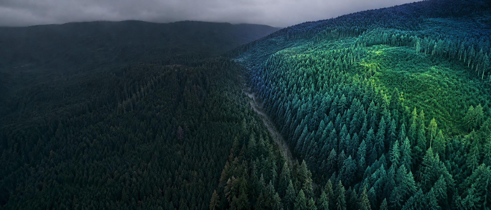
Bare-earth terrain, under the canopy, in a day.
Drone LiDAR survey across Vancouver Island and British Columbia. Classified point clouds, DTM and DSM rasters and CAD-ready contours, accurate to 5cm horizontal and 4cm vertical against RTK ground control — on sites where photogrammetry cannot see the ground at all.
What is drone LiDAR?
LiDAR stands for light detection and ranging. A sensor mounted under the aircraft fires laser pulses at the ground many thousands of times per second and measures how long each one takes to return. Combined with a precise record of where the aircraft was and how it was oriented at the moment of each pulse, that timing becomes a three-dimensional coordinate. Fly a planned grid over a site and you build a dense cloud of millions of measured points.
The important part is what happens next. Because a laser pulse can slip through a gap in the canopy and return from the forest floor, a single flight records both the top of the vegetation and the ground underneath it. Classification separates the two, and what you are left with is a bare-earth terrain model of ground you cannot see from the air — the thing that photogrammetry, which can only measure what a camera can see, is structurally unable to produce.
Where it earns its cost
On open ground, photogrammetry is cheaper and the result is comparable. LiDAR pays for itself when the site is forested, when you need terrain rather than surface, when the corridor is long and narrow, or when the accuracy requirement is tight enough that you need a measurement method rather than an interpolated one.
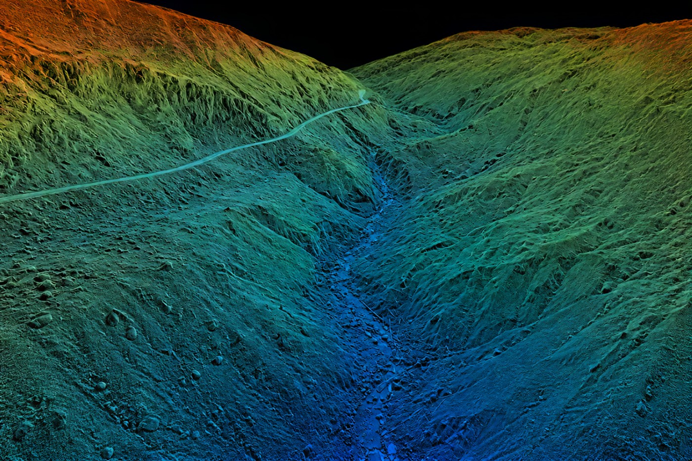
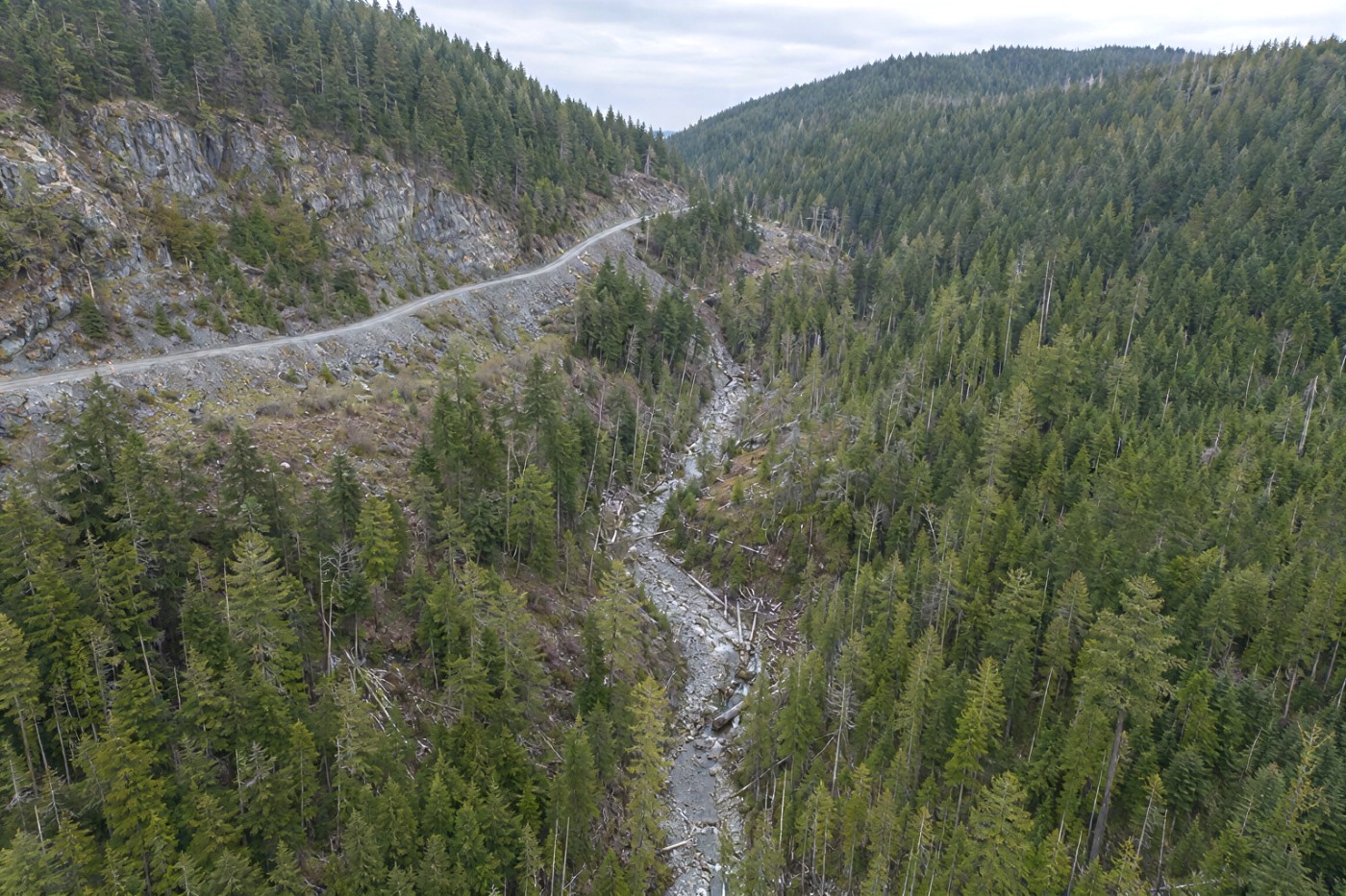
Drag the divider, or use the arrow keys, to strip the vegetation away.
Why LiDAR instead of a ground crew or a manned aircraft?
Against a ground survey crew
A two-person crew with a total station or GNSS rover measures points one at a time. On a forested 30-hectare site that is days of work at a few thousand points, walking terrain that is often steep, wet and covered in slash. A LiDAR flight over the same site takes a few hours and returns tens of millions of points, and nobody spends a day on a slope with a chainsaw-cleared sightline.
The trade is that a ground crew can measure a specific feature to a specification a laser cannot — which is why the two methods are complementary rather than competing. We regularly fly terrain for firms who then send a crew for the details that matter.
Against manned aerial LiDAR
Fixed-wing and helicopter LiDAR is the right answer above roughly a few hundred hectares, and the economics are clear at that scale. Below it, mobilising an aircraft and crew for a single site on the Island is expensive, weather-dependent on a longer planning horizon, and flies too high to give you the point density a construction or quarry site needs.
A drone flies at 60 to 120 metres, which means a far denser cloud on a small footprint, and can be on site the week you call rather than the month.
Against drone photogrammetry
Photogrammetry builds a surface from overlapping photographs. On bare ground it is excellent and it is what we recommend. Under vegetation it fails, because the algorithm reconstructs the top of the canopy and has no information about what is beneath it — and it will produce a confident, smooth, entirely wrong terrain model rather than an error.
If your site has trees, brush or standing crop and you need ground elevations, photogrammetry is not a cheaper version of LiDAR. It is a different measurement that does not answer your question.
What clients use it for
Forestry terrain and cutblock layout
Bare-earth models under second-growth canopy for road layout, grade design and stream identification, plus canopy height models from the same flight. This is the application where LiDAR is not just better but necessary, and it is the largest single opportunity on the Island. Forestry services.
Pre-construction topography
Existing-ground surfaces for civil design, cut-and-fill modelling and drainage, on sites where clearing has not happened yet and the designer needs terrain rather than treetops. Delivered as DXF contours and a DTM your civil software imports directly. Construction services.
Stockpile and pit volumetrics
Inventory reconciliation on aggregate and quarry operations, where a measured surface beats a truck count. Repeat flights on a schedule give you drawdown over time rather than a single snapshot. Volumetric survey and mining services.
Corridor and right-of-way mapping
Transmission lines, pipelines, forest service roads and rail. Long thin sites are inefficient for ground crews and ideal for a planned drone corridor mission, with vegetation clearance measured off the classified cloud rather than estimated.
Slope and highwall assessment support
Dense terrain data for the engineer who is doing the assessment. We supply the measurement; the stability judgement is theirs. Repeat surveys quantify movement between visits.
Environmental and reclamation baselines
A dated terrain and vegetation record before work starts, and matched surveys afterwards to demonstrate what changed. Useful in permitting, and considerably more persuasive than photographs.
Specifications, in writing
Every job ships with a method and accuracy note stating what was achieved on that site, not what is achievable in ideal conditions.
| Deliverable | Format | Notes |
|---|---|---|
| Classified point cloud | LAS 1.4 / LAZ | Ground, low/medium/high vegetation, building, noise classes |
| Bare-earth terrain model | GeoTIFF DTM | Grid resolution to suit the project, typically 0.25–0.5 m |
| Surface model | GeoTIFF DSM | First-return surface including vegetation and structures |
| Contours | DXF / SHP | Interval of your choosing; 0.25 m and 0.5 m most common |
| Canopy height model | GeoTIFF | DSM minus DTM. Forestry work, on request |
| Breaklines | DXF | Manually delineated. Quoted separately — it is desk time |
| Orthomosaic | GeoTIFF | From the paired camera on the same flight |
| Method & accuracy note | Control network, check point residuals, achieved accuracy |
| Horizontal accuracy | 5 cm |
|---|---|
| Vertical accuracy | 4 cm |
| Aircraft RTK positioning | 1 cm + 1 ppm |
| Positioning | RTK + ground control |
| Flight height | 60–120 m AGL |
| Single-day coverage | up to ~40 ha |
| Standard turnaround | 72 hours |
| Coordinate system | NAD83(CSRS) UTM 10N |
| Vertical datum | CGVD2013 |
Accuracy figures are manufacturer system specifications, verified per job against independent check points excluded from the solution. The 1cm figure is the aircraft’s RTK positioning accuracy and describes where the aircraft knows itself to be, not the accuracy of the deliverable. Achieved accuracy varies with terrain, canopy density, flight height and control distribution, and is stated per job. Deliverables are for information and planning purposes — not a legal survey.
What flies, and what it carries
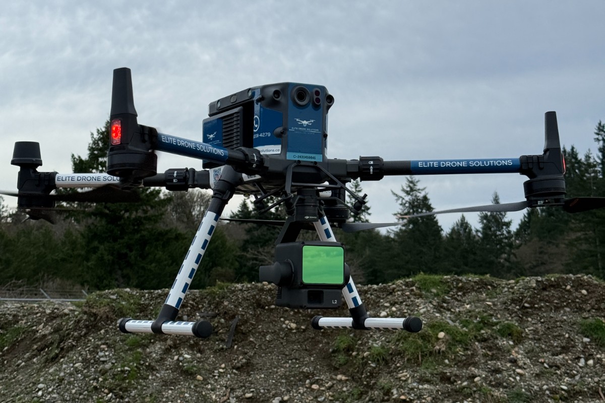
Technical buyers search by platform and sensor, so here it is plainly. Acquisition is flown on a DJI Matrice 350 RTK — 55 minutes of endurance, IP55 rated for the weather this coast actually has, and fitted with a ParaZero safety parachute that permits operations closer to people than an unequipped airframe.
The LiDAR payload is matched to the job rather than fixed to the airframe, so a survey gets the correct sensor rather than whatever is on the shelf — it carries a short lead time, which we confirm at the quote stage and build into your date. Positioning is RTK-corrected against an EMLID Reach RS2 base station established on site, with Propeller AeroPoints laid out as self-surveying ground control and a separate set of check points held back to verify the result. Secondary and confined-access work is flown on a DJI Mavic 4 Pro.
Processing runs through a photogrammetric and LiDAR pipeline with manual classification review — we do not ship an automatic classification without a human looking at it, because automatic ground classification under dense conifer is where these datasets go wrong.
How a LiDAR job runs
-
Scope the accuracy
What the data is for determines the control network and the flight plan. A designer needing 0.5 m contours and a quarry reconciling inventory to a tonne are different jobs. We size the survey to the requirement rather than over-delivering and billing for it.
-
Plan and authorise
Mission planning, airspace review and any Transport Canada or NAV CANADA authorisation. Sites near YYJ, YCD and YBL frequently sit in controlled airspace, and that clearance is arranged before we mobilise.
-
Control and capture
Base station established, ground control and check points set and observed, then the planned mission flown with coverage and return density verified on site before demobilisation.
-
Process and classify
Trajectory solution, point cloud generation, automatic classification followed by manual review, then surface and contour generation. Residuals checked against the withheld control.
-
Deliver and walk through
Files in your coordinate system and formats, the method and accuracy note, and a call with whoever is using the data if this is their first LiDAR dataset.
Ask to see the work
The fastest way to judge a survey provider is to look at what they hand over. Ask for a sample deliverable from work of the same type as yours and we will send one, with the client's identifying detail removed.
A sample deliverable
A classified point cloud tile, a bare-earth surface under canopy, or a method note from a comparable job. Looking at a real deliverable tells you more about whether we can serve you than a paragraph about somebody else's site.
Architectural visualisation
Elite Drone Solutions has provided us with quality and great service. Their team is easy to work with and very professional. We would definitely recommend them to anyone that is looking for aerial work on Vancouver Island.
What your procurement team will ask for
We fly under a Transport Canada Advanced Operations certificate with licensed pilots, which is the level required to operate in controlled airspace and near people — and the level most owner-operators do not hold. Airspace authorisations are obtained before mobilisation, and the airframe carries a certified parachute for work near occupied areas.
We carry $5M in aviation liability insurance and a certificate is available on request for your project file. Site safety orientation is completed on arrival and we work to the host contractor's requirements.
Survey deliverables are provided for information and planning purposes and do not constitute a legal survey. Boundary, legal plan and statutory right-of-way work requires a British Columbia Land Surveyor. We do not provide engineering assessments or geotechnical opinions; measurement data is supplied for a qualified professional to interpret.
- Transport Canada Advanced Operations certificate
- Licensed pilots, current flight reviews
- $5M aviation liability insurance, certificate on request
- WorkSafeBC clearance letter available
- Site-specific safety plan on request
- Airspace authorisation handled by us
LiDAR survey across Vancouver Island
Based in Victoria, mobilising Island-wide and to the mainland for larger programs. Travel beyond the Capital Regional District is quoted at cost and stated up front.
Victoria & Saanich Peninsula
Same-week mobilisation. Controlled airspace around YYJ handled routinely.
Langford & the Westshore
Heavy residential and commercial development. Progress and pre-construction work.
Nanaimo & central Island
Industrial, port and aggregate operations. YCD airspace coordination.
Duncan & Cowichan Valley
Forestry tenures, agricultural land and gravel operations.
Courtenay & Comox
Forestry and development work on the north Island. YBL coordination.
Elsewhere in BC
Mainland and remote programs quoted on a mobilisation basis.
Drone LiDAR, answered
How accurate is drone LiDAR?
System accuracy on a Zenmuse L2 is specified by the manufacturer at 5cm horizontal and 4cm vertical at 150m flight height, measured in laboratory conditions. Real jobs are flown lower and carry ground control, and we verify the result against independent check points withheld from the solution. We state the accuracy actually achieved in the delivery note rather than quoting a best case, and we will not quote the aircraft’s 1cm RTK positioning figure as though it were deliverable accuracy — it is not.
Can drone LiDAR see the ground through trees?
Yes, and this is the main reason to choose LiDAR over photogrammetry on Vancouver Island. A laser pulse can pass through gaps in the canopy and return from the forest floor, so classification can separate vegetation from bare earth. Photogrammetry cannot do this because it can only measure surfaces the camera can see. Penetration depends on canopy density and leaf condition; dense second-growth conifer returns fewer ground points than an open deciduous stand.
What file formats do you deliver?
Classified point clouds as LAS or LAZ, terrain and surface models as GeoTIFF DTM and DSM, contours as DXF or SHP at your chosen interval, and breaklines on request. We deliver in the coordinate system and vertical datum your project uses, typically NAD83(CSRS) UTM Zone 10N with CGVD2013 heights.
How long does a LiDAR survey take?
A site up to roughly 40 hectares is usually a single mobilisation day. Standard processing and delivery is 72 hours from the flight for sites of that size; larger areas, heavy canopy classification and tight datum requirements add time. If you have a deadline, tell us at the quote stage and we will confirm whether it is achievable before you commit.
Is a drone LiDAR survey a legal survey?
No. Our deliverables are provided for information and planning purposes and are not a legal survey. Anything relating to a property boundary, a legal plan or a statutory right of way must be carried out by a British Columbia Land Surveyor. We work alongside BCLS firms regularly and can supply terrain data for them to work from.
Do you need site access or can you fly from the road?
We need enough access to set ground control targets and to establish a safe launch and recovery area with visual line of sight to the aircraft. On most working sites that is straightforward. Where access is restricted, we discuss options at the quote stage, including whether a reduced control network is acceptable for the accuracy the project needs.
Tell us about the site
Location, rough area, what the data is for and your timeline. That is usually enough to quote without a site visit, and we reply within one business day.
If the job turns out to need a legal survey, a total station or a manned aircraft, we will say so and point you at someone who does it. We would rather lose a quote than deliver the wrong measurement.